3.4.1.3.2. Gamma Nought
Gamma Nought (GMR) or terrain-flattened Gamma Nought is a new concept that integrates terrain variations into the variation of the reflected radar signal.
Product overview
Gamma Nought (GMR) or terrain-flattened Gamma nought is a new concept that integrates terrain variations into the variation of the reflected radar signal. Therefore, the characteristics and data format of this product are very similar to Sigma Nought, except the nature of the contained data. Since an Austrian high-resolution digital elevation model (DEM) was used in this project, it is now possible to generate a GMR product at a very high resolution of 20m, instead of ~200m when using the popular 90m SRTM DEM.
Product description
The processing of the GMR product is carried out with the TU Wien SAR Geophysical Retrieval Toolbox (SGRT), which is a software for geophysical parameter retrieval from SAR imagery developed at TU Wien. In the following sub-sections, the main characteristics and the data format of the Sentinel-1 GMR product will be presented.
Product variables
The following table presents the data format of the GMR product after the processing at TU Wien.
| Code name | Scaling factor | Units | Type | Pixel size (m) | Image dimension | No-data | Number of bands |
|---|---|---|---|---|---|---|---|
| GMR | 100 | Decibel | int16 | 10,10 | 10000x10000 | -9999 | 1 |
Overview of the Sentinel-1 Gamma nought product
Area and time period
The GMR product is provided over Austria from 01st January 2016 to the present.
Temporal resolution
The temporal resolution of the GMR product is up to 3-4 days over Austria in practical.
Polarisation
Similar to Sigma Nought,
the polarisation of the GMR product is given by the polarisation of the input Sentinel-1 data. In the case of dual-polarised SAR data, different polarisation will be stored in separate files. Thus, after pre-processing, one dual-polarised Sentinel-1 input file results in two GMR images with the same time stamp.
The figure below is a visualisation of VV and VH-polarised GMR data over the same area and with the same color scale.
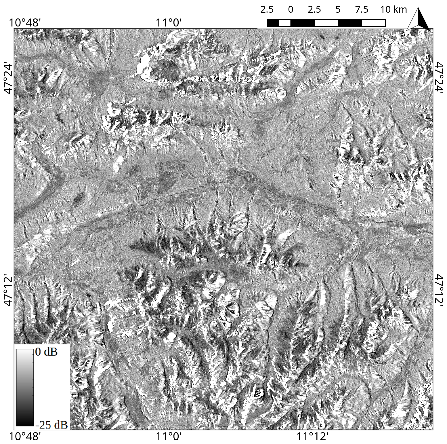 |  |
Sentinel-1 Gamma nought or backscatter coefficient product at 10m spatial sampling, with VV polarisation (left) and VH polarisation (right). The scene covers the area of western Innsbruck, Austria, taken on 21st April 2016, 5:26:30.
Image timestamps
The timestamp of the GMR product is included in the filename, according to the Sentinel file naming convention. It can also be found in the GeoTIFF header.
Spatial resolution and sampling
After the pre-processing at TU Wien, the GMR images are tiled and georeferenced using the TU Wien Equi7 grid system (see Data specifications and formats) and have easting and northing coordinates with a pixel spacing of 10m.
Original data format
The GMR data is originally stored and delivered in GeoTIFF format. GeoTIFF is a standard which allows storing georeferencing information within a TIFF raster image.
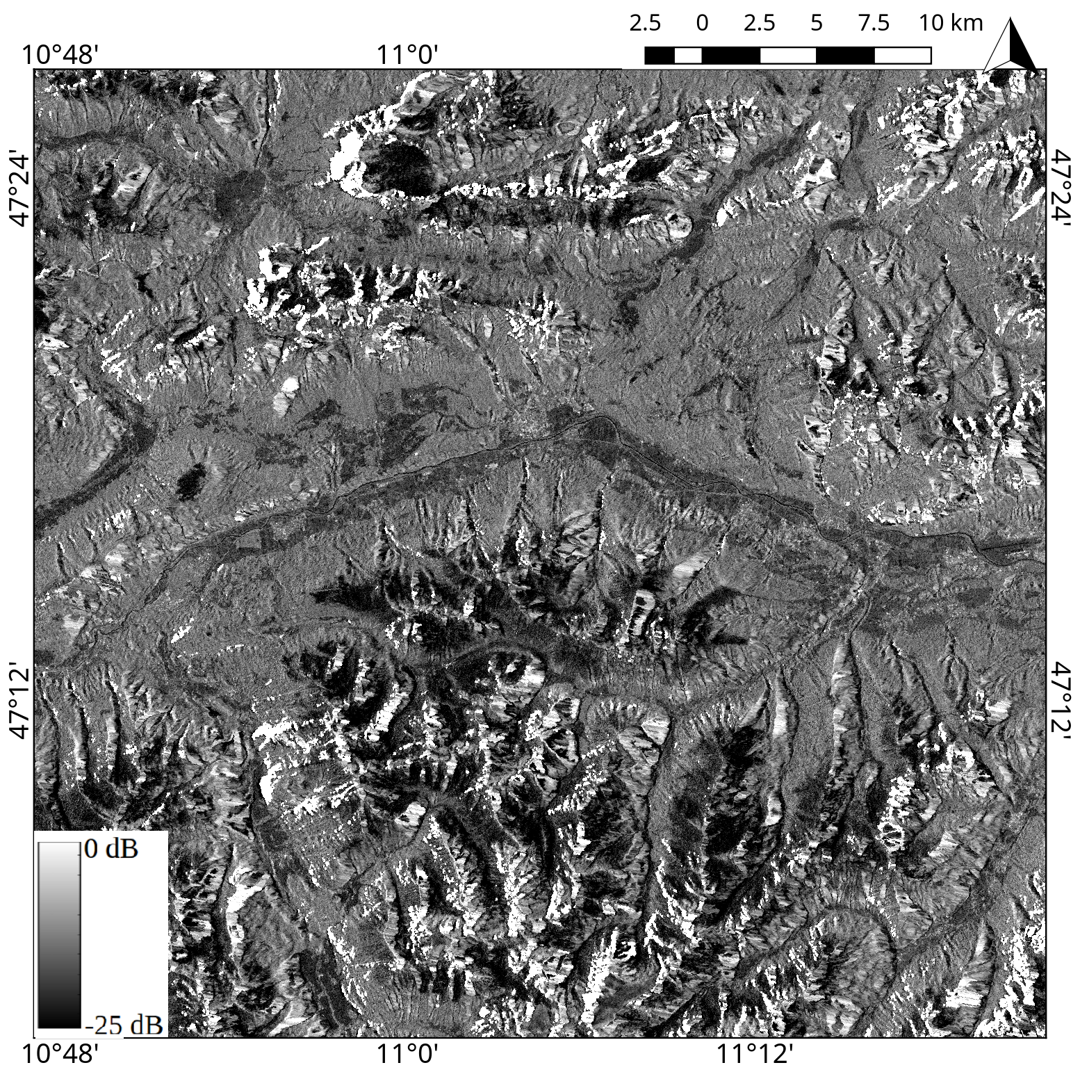
Sentinel-1 Gamma nought product at 10m spatial sampling, retrieved with VH polarisation. The scene covers the area of western Innsbruck, Austria, taken on 21st April 2016, 5:26:30.
| Product Name | Gamma nought |
|---|---|
| Code Name | GMR |
| Category | Sentinel-1 products |
| Spatial Sampling | 10m |
| Temporal Resolution | 3-4 days |
| Unit | Decibel |