3.4.3. Digital elevation model
A Digital Elevation Model (DEM) is a 3D computer graphics representation of a terrain's surface – commonly of a planet (e.g. Earth), moon, or asteroid – created from a terrain's elevation data. A DEM can be represented as a raster (a grid of squares, also known as a heightmap when representing elevation) or as a vector-based triangular irregular network (TIN). The TIN DEM dataset is also referred to as a primary (measured) DEM, whereas the Raster DEM is referred to as a secondary (computed) DEM. The DEM could be acquired through techniques such as photogrammetry, lidar, IfSAR, land surveying, etc.
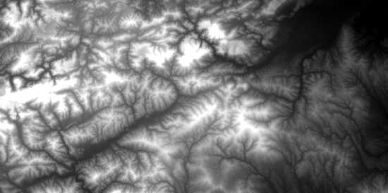
Example of the topographic data from the Shuttle Radar Topography Mission (SRTM).