3.4.1.3.3. Projected Local Incidence Angle
Projected Local Incidence Angle (PLIA) is the angle between the surface normal and the looking direction of the satellite or the Local Incidence Angle (LIA) projected into the range plane.
Product overview
The projected local incidence angle (PLIA) is the angle between the surface normal and the looking direction of the satellite (LIA), which is further projected into the range plane. In short, the PLIA accounts for local slopes being highly influenced by topography. Within the Austrian Data Cube project, the Sentinel-1 data are processed using a high-resolution digital elevation model (DEM). This enables a PLIA retrieval with a spatial resolution of 20m. The processing of the PLIA product is carried out using the TU Wien SAR Geophysical Retrieval Toolbox (SGRT), which is a software for geophysical parameter retrieval from SAR imagery developed at TU Wien.
DEM influence on the PLIA product
Despite being less visible in other products, the use of the Austrian high-resolution DEM has a great influence on the actual resolution of the PLIA. The figure below compares PLIA products over the same area, where each is based on a different DEM.
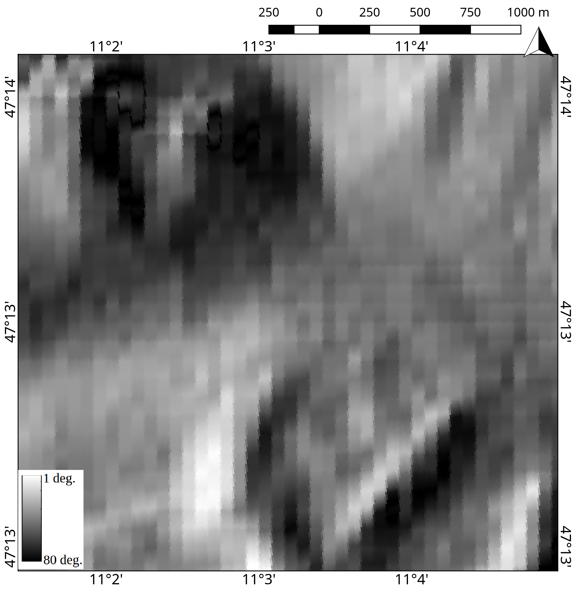 | 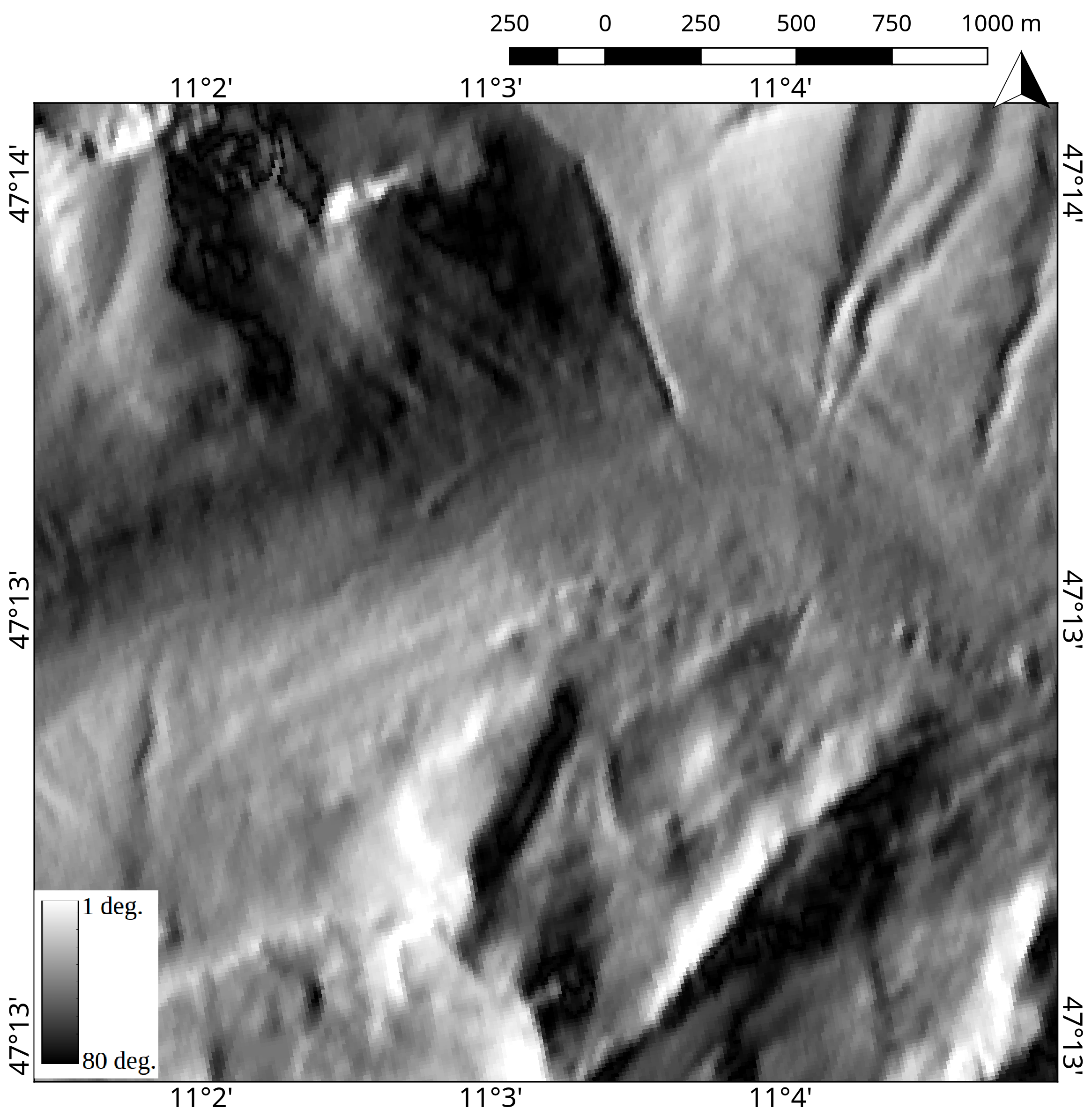 |
Sentinel-1 PLIA over western Innsbruck, Austria, taken on 21st April 2016, 5:26:30 processed with the SRTM 90m DEM (left) and the Austrian high-resolution DEM (right).
Product description
Generally, one PLIA image slice is retrieved after the processing of one Sentinel-1 input file. Theoretically, the difference between two PLIA of the same orbit track is small and therefore, can be neglected. However, within this project, we provide one PLIA image for every pre-processed timestamp. In the following sub-section, the detail product format and important characteristics will be presented.
Product variables
The following table offers an overview for the PLIA product after the processing at TU Wien.
| Code name | Scaling factor | Units | Type | Pixel size (m) | Image dimension | No-data | Number of bands |
|---|---|---|---|---|---|---|---|
| PLIA | 100 | Degree | int16 | 10,10 | 10000x10000 | -9999 | 1 |
Overview of Sentinel-1 PLIA variables
Area and time period
The PLIA product is provided over Austria from 01st January 2016 to the present.
Temporal resolution
As discussed above, the temporal resolution of the PLIA product matches with the pre-processed Sentinel-1 backscatter images. An acquisition over Austria takes place approximately every 3-4 days.
Image timestamps
The timestamp of the PLIA product is included in the filename, according to the Sentinel file naming convention. It can also be found in the GeoTIFF header.
Spatial resolution and sampling
After the pre-processing at TU Wien, the PLIA images are tiled and georeferenced using the TU Wien Equi7 grid system(see Data specifications and formats) and have easting and northing coordinates with a pixel spacing of 10m.
Original data format
The PLIA data is originally stored and delivered in GeoTIFF format. GeoTIFF is a standard, which allows storing georeferencing information within a TIFF raster image.
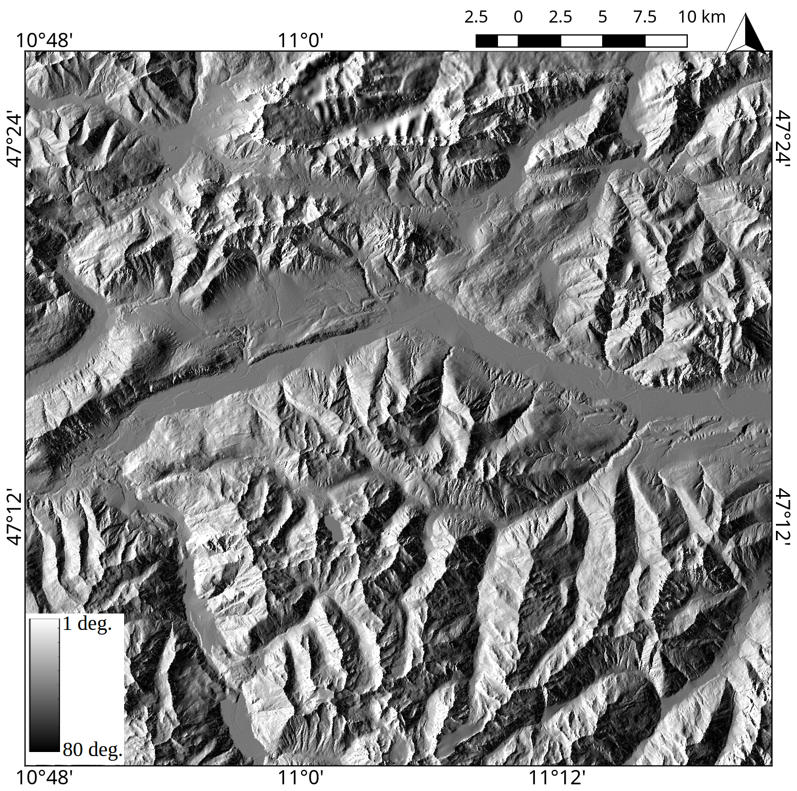
Sentinel-1 Projected Local Incidence Angle product at 10m spatial sampling. The scene covers the area of western Innsbruck, Austria, taken on 21st April 2016, 5:26:30.
| Product Name | Projected Local Incidence Angle |
|---|---|
| Code Name | PLIA |
| Category | Sentinel-1 products |
| Spatial Sampling | 10m |
| Temporal Resolution | 3-4 days |
| Unit | Degree |